We have been spoiled for several weeks with temperatures well above normal for the month of November. This week, temperatures are expected to reach into the 60s, possibly a few 70s which is well above the 40-degree highs we typically see this time of year.
Looking at forecast models, some models are showing changes in the weather with an increase in precipitation and much cooler weather by the end of the upcoming weekend or the start of the next workweek.
A large dip in the jet stream along with a low-pressure storm system looks to start impacting the state by late Sunday or the start of Monday. This system looks to bring chances of rain or even snow as cold temperatures spill into the region.
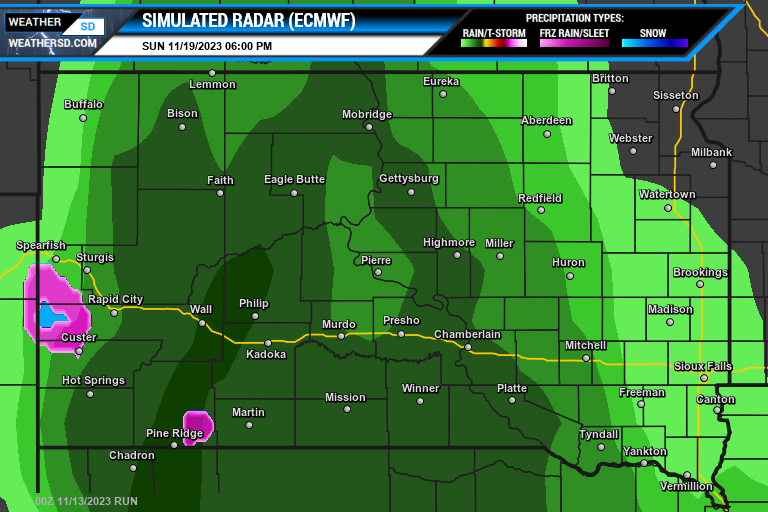
There remains many factors in this forecast due to another low-pressure system across the northwest United States and parts of southwest Canada that could affect the other storm system. Models still do not agree on the precipitation as the American (GFS) model is delaying the precipitation and forecasting less moisture but the Euro (ECMWF) is showing a different story with more precipitation and starting earlier.
Sunday Evening Simulated Radar Maps:
Monday's Morning Simulated Radar Maps:
Please keep checking back with WeatherSD for new updates on this storm system. You can also view the latest forecast model maps on our Maps Page and you can check out your 10-day local forecast on our Forecast Page.


