Snowy and Windy Weather Continues
- WeatherSD
- Apr 7, 2022
- 2 min read
Updated: May 7, 2022
The weather is going to remain active with strong winds will be persistent along with chances of snow in the east.

Photo Credit: South Dakota Department of Transporation
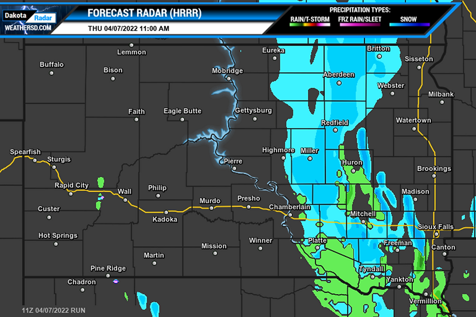
Precipitation bands will continue to filter down from the north across the eastern half of the state where Winter Weather Advisories are in effect for parts of northeast and east-central, South Dakota. Generally, two to four inches are expected with isolated higher amounts possible.


The rain or snow will start to diminish by this evening and into the overnight hours. This will start a dry period for the weekend as warmer temperatures move back into the region. High temperatures for Saturday look to be into the 50s and 60s for the most part with a few 70s in the southwest. Skies will be from mostly sunny to partly cloudy. The winds will also be lighter than what you will find today with southern winds from 5 to 20mph.

Winds today will once again be strong with High Wind Warnings and Wind Advisories posted once again for the majority of the state as wind gusts will be anywhere from 45 to 60mph are expected. There is light at the end of the tunnel as the winds are forecast to decrease by this evening across the west. It will be a slow decrease for those in the east, as the winds will remain breezy through the overnight hours and into Friday.


Yesterday's wind gusts were strong once again with a 64mph gust reported at the Rapid City Airport. At the Sisseton Airport, a 62mph gust was recorded in northeast, South Dakota, and over by Spink Colony they too saw a 62mph gust. Box Elder and over by Folsom, a wind gust of 60mph was reported.

Photo Credit: Hand County Sheriff's Office
Snow amounts from yesterday were high in the Black Hills with 8 inches of snow fell just north of Mystic. At Cheyenne Crossing in the northern Black Hills, 6 inches was on the ground, and over by Brownsville, the same was reported. Deadwood received 5 inches of new snow and 4.5 inches was found near Deerfield. A few miles west from downtown Spearfish, only 2 inches was reported, and towards the south near Pactola Reservoir, 1.8 inches was recorded.
For the latest forecast, please check out our Forecast Page and for the latest weather alerts, those can be found on our Weather Alerts page.

